
SandFlow — is tool for reservoir connectivity analysis in a sand formation based on the similarity of gamma ray logs shapes of drilled wells.
The output is a map that, in combination with an net reservoir map, will show the direction of connectivity of sandstone reservoirs. In the future, the connectivity map can be used to set targets for drilling new wells, as well as when analyzing the development and construction of residual reserves.
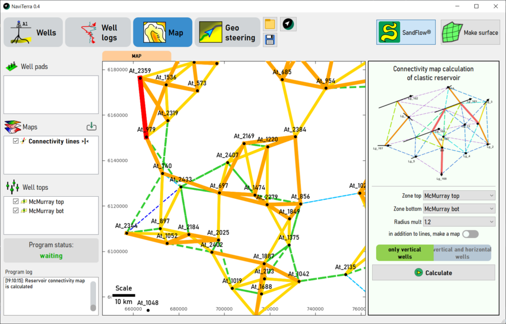
SandFlow can also be considered as an alternative to well testing, while the SandFlow analysis will be free from the uncertainty of mutual influence of well operation, since the reservoir connectivity between wells is directly analyzed. SandFlow will be most effective for complex, heterogeneous clastic reservoirs.
Other features of NaviTerra of 0.4 version:
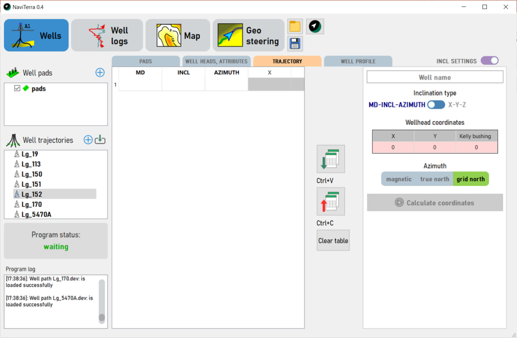
- Well trajectory loading, coordinates, horizontal drift, DLS calculating
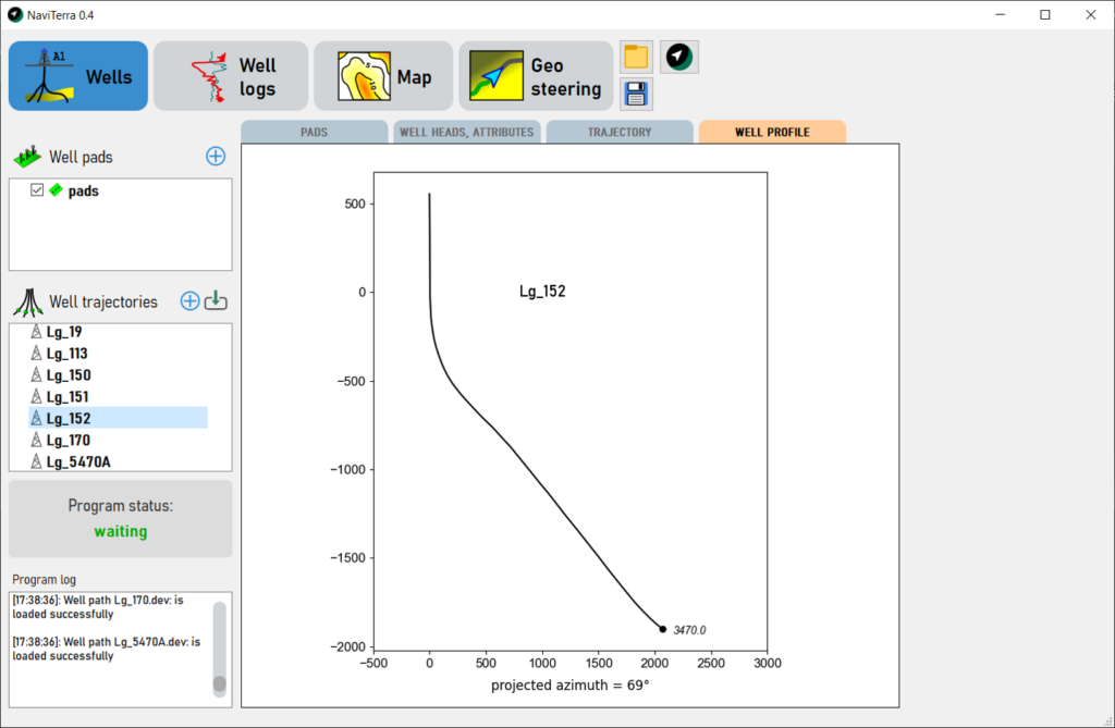
- Visualisation of well trajectories on map, visualisation of vertical section of well
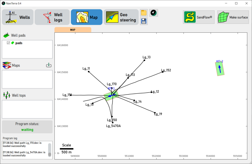
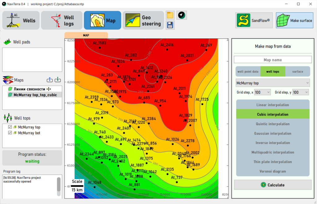
- Visualisation of well pads on map
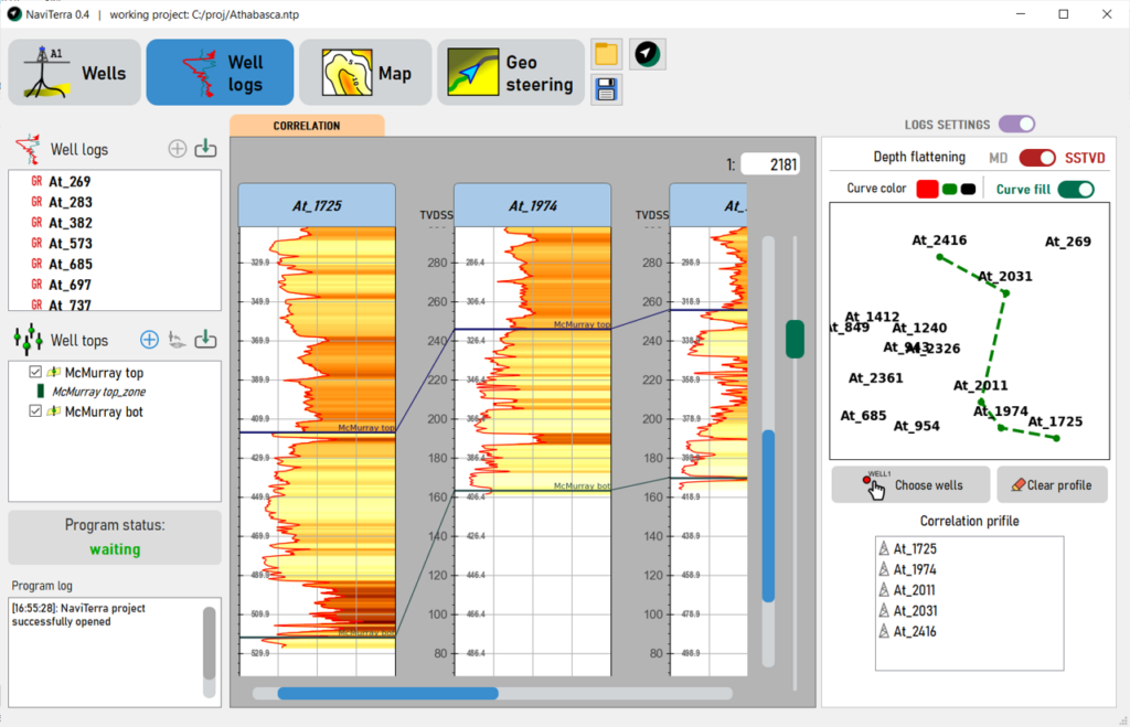
- Interactive building of well correlations
- Import of map grids of irap classic grid and CPS-3 grid formats
- Making maps using well top markers
NaviTerra software that includes SandFlow module can be downloaded on this page